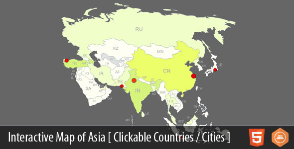
Discover the power of interactive geography with this professionally designed map of Asia template. This versatile solution features 46 clickable countries and supports unlimited customizable location markers, transforming static maps into dynamic navigation tools for your website visitors.
Comprehensive Features for Enhanced User Engagement
This interactive Asia map goes beyond basic geography with these capabilities:
- Precise Country Targeting: All 46 Asian nations are pre-configured as clickable regions with hover effects
- Custom Pin Creation: Add unlimited markers for cities, landmarks, or business locations
- Multi-Platform Compatibility: Fully responsive design works on smartphones, tablets, and desktops
- Dynamic Content Integration: Link each element to webpages, popups, or multimedia content
- Efficient SVG Technology: Scalable vector graphics ensure crisp rendering at any resolution
Dual Implementation Options
Choose the integration method that fits your technical environment:
WordPress Plugin Solution
Ideal for content management system users, the plugin version offers:
- One-click installation through WordPress admin panel
- Visual editor for point-and-click marker placement
- Automatic updates and version management
- Compatibility with major page builders and themes
JavaScript Template Framework
For custom development scenarios, the JavaScript version provides:
- Full source code access for complete customization
- API hooks for dynamic data integration
- Cross-platform compatibility without CMS dependencies
- Modular architecture for selective feature implementation
Practical Applications Across Industries
This interactive map template serves diverse business needs:
- Educational Platforms: Create country information portals with demographic data layers
- Travel Agencies: Showcase tour packages with region-specific popups
- International Businesses: Visualize global offices with contact information overlays
- News Organizations: Plot crisis locations with real-time update capabilities
- Government Portals: Display administrative regions with census data integration
Implementation Made Simple
Get your map operational in three straightforward steps:
- Customize geographic elements through the intuitive dashboard interface
- Connect regions and markers to relevant content destinations
- Embed with a single line of code or WordPress shortcode
For immediate implementation, explore the live preview to experience the interface functionality firsthand.
Extend Your Mapping Capabilities
Looking for broader geographic solutions? Test drive our comprehensive interactive world map template available as a free download. This complimentary version demonstrates the same robust functionality scaled for global applications, providing a risk-free opportunity to evaluate the technology framework.
Optimized Performance Specifications
The solution leverages modern web standards for peak efficiency:
- Google Maps API integration for address geocoding
- Latitude/longitude coordinate precision
- Lightweight architecture for fast loading
- Cross-browser compatibility (Chrome, Firefox, Safari, Edge)
- Touchscreen gesture support for mobile users